 Part I – Assess your natural assets and identify key threats
Step one
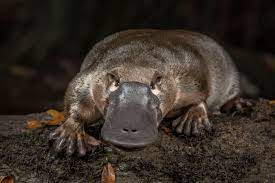
The first step to any successful restoration project is good planning. A site assessment of the project area will identify the native vegetation class, its resilience and any threats that may impact or influence natural regeneration processes. My favourite part of my role as Private Land Conservation Officer at MidCoast 2 Tops Landcare, is meeting landholders and walking over their property, assessing native vegetation condition. I use a random meander method – we go for a long walk through the bushland remnant, and I record all the plant species I encounter, take samples of the ones I don’t know so I can identify them at home, and make general notes about the land management history, key threats (such as grazing pressure, altered hydrology or fire regimes, slashing, erosion; weeds) and habitat metrics, such tree size, presence and density of hollows, groundlayer habitat features (rocky outcrops, fallen timber etc). I also keep an eye out for tracks, scats and other signs of fauna occupation.
The site assessment process for an entry-level conservation agreement (Land For Wildlife-LFW) then involves the classification of key vegetation classes, an overview of the habitat values, and key threats. The LFW process classifies 12 broad vegetation types, but I encounter two vegetation classes most commonly in this area – Rainforest (Closed Forest) and Wet Sclerophyll Forest (also Reconstructed or Other Habitat). Within these two very broad native vegetation classes, there are many subcategories, called Plant Community Types (PCT), which are highly specific and distinguished by geography and species composition. A great resource for determining vegetation types on your property is the Trees near Me app, which gives the statewide mapping of vegetation classes; and is a neat tool that also predicts pre-clearing vegetation classes. The app also provides a full species list for each vegetation PCT. Whilst this tool is very handy, there are limitations, and not all of the mapping has been ground-truthed in our area. I also find that the vegetation I am seeing on my property visits is often a combination of more than one of PCT’s listed. This may be a result of historical disturbance, fragmentation and land use management, and is another reminder that nature and ecology will not always comply with our rigid classification systems, particularly in highly modified landscapes and changing climatic conditions.
The site assessment process for an entry-level conservation agreement (Land For Wildlife-LFW) then involves the classification of key vegetation classes, an overview of the habitat values, and key threats. The LFW process classifies 12 broad vegetation types, but I encounter two vegetation classes most commonly in this area – Rainforest (Closed Forest) and Wet Sclerophyll Forest (also Reconstructed or Other Habitat). Within these two very broad native vegetation classes, there are many subcategories, called Plant Community Types (PCT), which are highly specific and distinguished by geography and species composition. A great resource for determining vegetation types on your property is the Trees near Me app, which gives the statewide mapping of vegetation classes; and is a neat tool that also predicts pre-clearing vegetation classes. The app also provides a full species list for each vegetation PCT. Whilst this tool is very handy, there are limitations, and not all of the mapping has been ground-truthed in our area. I also find that the vegetation I am seeing on my property visits is often a combination of more than one of PCT’s listed. This may be a result of historical disturbance, fragmentation and land use management, and is another reminder that nature and ecology will not always comply with our rigid classification systems, particularly in highly modified landscapes and changing climatic conditions.
Step two
The next step is to prioritise restoration actions, and this is where reading the resilience of your site is pivotal to success. As a general rule of thumb, it is always best to work in the areas with the strongest resilience first – remove priority weeds and allow nature to recover. Removing grazing pressure from these zones is imperative to the restoration of bushland. Allow remnants to expand into cleared areas. Always adhere to the three rules or restoration:
- Do no harm – Retain all native vegetation, even if it is in poor condition, we need to protect all of our remnant bushland
- Regenerate – support your bushland remnant by removing key threats, such as weeds, grazing, slashing, unnatural fire regimes. Maintain all bush regeneration zones before starting new areas. (Follow-up; Follow-up; Follow-up. Forever)
- Observe the site and only replant if there is no natural regeneration; or if key identifier native species are still missing once the site has stabilised. (This is where reference sites of intact bushland of the same PCT are needed).
When planning weed control works, you may need to think about working your site in a mosaic pattern, working with the strength of your site, for example – weeding under existing native canopy patches in the first instance. These patches will respond to weed removal and you may be able to expand them, as natural regeneration occurs. Restoration works do not necessarily need to be linear – a patchwork approach is often better in highly disturbed and fragmented areas. A mud map is also a good tool to guide regeneration works.
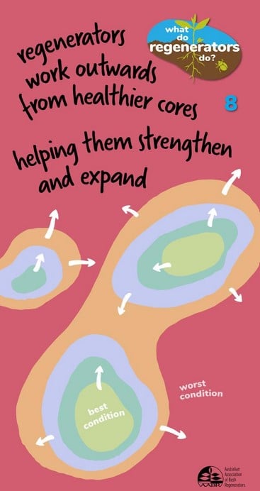
Image credit: Australian Association of Bush Regenerators
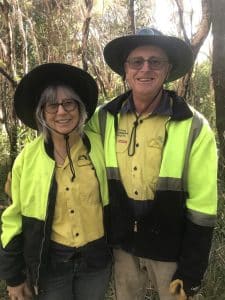
If you would like advice on your restoration works, I am available to assist with site inspections and prioritisation for landholders with existing Conservation Agreements, or any new landholders interested in signing up for Land for Wildlife. Send me an email mc2t.plconservation@gmail.com or complete an EOI here